British Geological Survey: 10 years of sharing
A decade on from its launch, OpenGeoscience has changed the face of research and decision-making
THIS month marks a decade since the British Geological Survey (BGS) launched OpenGeoscience, an online portal that has made a vast array of open UK geological data searchable and more accessible for everyone to use.
Launched in December 2009, OpenGeoscience was originally created to allow further study of the UK’s rocks. Highlights included a simple Google map style interface to the BGS digital geology map for Great Britain – a world first in terms of releasing nationwide digital geological data in high resolution for anyone to study and re-use.
The BGS also released thousands of photos through the portal to illustrate and categorize some of the country’s most fascinating geological features.
Ten years on, the portal has expanded dramatically and now provides a home for an extensive suite of free-to-view educational tools and resources, in addition to the GeoIndex for professional users, which benefits more than 80,000 visitors every month.
This vast trove of information now includes access to more than 1 million borehole logs, 6,000 scanned versions of maps, 3D-scanned fossils and more than 3,000 online documents, memoirs and publications covering 184 years of geoscience.
Users can explore different rock types and access dozens of layers of data, detailing everything from bedrock geology to important minerals, soil types, groundwater levels, and hydrocarbon wells. Users can even access seabed samples and drill virtual boreholes in selected locations.
Between 1–10 December, the BGS is marking a ‘decade of data’ by showcasing some of the extraordinary benefits of making its geological data freely accessible.
‘We’ve found that the data has made a significant difference to a diverse range of professional, academic and recreational user groups, everyone from local authorities and universities, to the construction industry and emergency services, even a local caving club,’ said Professor Kate Royse, chief digital officer at the BGS.
Increasing numbers of private sector companies are using newly released geoscience data to expand existing information services and develop new products.
Access to the scanned collection of UK onshore borehole logs has grown by a factor of 100 since the service was launched. Today, more than 200,000 logs are accessed per month, with increasing numbers of site/ground investigation companies using the data when offering services for sustainable initiatives such as ground-source heat pumps and water well installations.
The same dataset is used for environmental assessments often carried out as part of local planning or development applications.
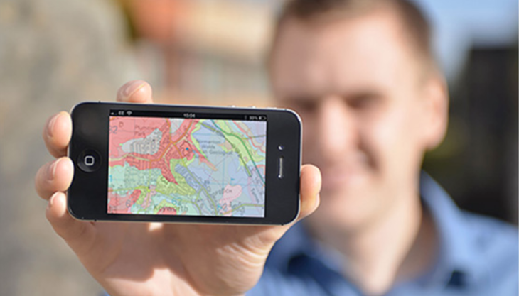
Meanwhile, the BGS’ popular geological map of Britain can still be viewed online, but a new 3D beta version is also available bringing a new immersive perspective to the geology of the UK. Its equivalent smartphone app, iGeology, helps users to ’discover the rocks beneath your feet wherever you go’ and can be downloaded anywhere. To date, the app has clocked over 370,000 downloads in more than 130 countries.
‘It’s not simply that data can be seen by more people or used more widely,’ added Prof. Royse. ‘What is more profound is that over the last decade the data has been leveraged, shared and meshed with other data, which makes it valuable not only for advancing research and scientific collaboration, but promoting learning, innovation and more informed decision-making.’


