Forterra Instrumental in River Recovery Scheme

First published in the May 2022 issue of Quarry Management
Support for river charity project improves river Mease for wildlife and people
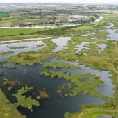
A recently completed water-quality project designed to slash levels of dangerous pollutants on the river Mease has already created valuable wetland habitats for loach, bullhead, crayfish and even otters. Four acres of formerly scrub-covered farmland have been transformed by the wetland sediment-trapping scheme, a kilometre from Measham, in Leicestershire, to help address the high levels of phosphates in the Mease.
The river, which encompasses a Site of Special Scientific Interest (SSSI) and Special Area of Conservation (SAC), has suffered because of the build-up of pollutants from many sources and from urban development. High levels of phosphates cause algae to bloom and reduce the levels of oxygen in the water, creating an environment where fish and other species can no longer survive.
But new ponds, wetland channels and riffles which make up a wetland sediment trap are already making a noticeable difference to the water quality and reducing phosphates, whilst woodland and vegetation, including nine old oaks, willow trees and hawthorns, have also been protected and can thrive once more because of the works at the site.
The £200,000 project, funded through a planning levy paid by developers, was only feasible because of ‘unprecedented’ collaboration and co-operation, according to The Trent Rivers Trust (TRT), the river restoration charity which led the work. The TRT worked with farmers whose land borders the river Mease and the Gilwiskaw brook, and with building products manufacturers Forterra.
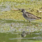
The sediment-trapping scheme, where the Gilwiskaw brook joins the river Mease, has created valuable new wetland habitat for nesting birds and invertebrates. Beyond phosphate entrapment, it will also help reduce the severity of any future flooding downstream. Major groundworks at the site started in the middle of July 2021 and were completed at the start of September.
Ruth Needham, senior catchment manager (West) at TRT, said: ‘It was an unusual one for the contractors because they normally work with trapezoid channels and straight lines. We showed them that wonky is good, and they quickly got the measure of doing curves rather than sharp angles.
‘We could see how much algae developed in some of the channels in just a few days. This shows just how high the levels of phosphate coming from upstream are. It’s bad, because it confirms the poor water quality coming on to site, but it’s also good in that what we’re doing is helping to trap the phosphate as we planned. With the whole site inundated with water, which it’s designed to be, it will catch a lot of phosphate.’
Phosphate levels are being monitored independently by TH Environmental, specialists in on-site river pollution sampling. A baseline report, based on samples before the project began, showed how the excessive phosphate levels were affecting the river Mease ecology and contributing to the failure of the river’s WFD (Water Framework Directive) target.
TH Environmental have developed a bespoke sampling plan to allow TRT to assess the performance of the scheme, which is designed to reduce phosphate levels in the river Mease and the Gilwiskaw brook. ‘The bespoke sampling plan is designed to gather evidence to quantify the phosphate load prevented from entering the river catchment,’ said TH Environmental director Tim Harris.
Funding for the project is through a Developer Contribution Scheme (DCS) administered by North West Leicestershire District Council and delivered for the council by TRT. The DCS seeks to mitigate the negative impacts of any developments which contribute wastewater to sewage treatment works which discharge into the catchment of the river Mease SAC. The DCS has been operational since 2012 and supports the river Mease Water Quality Management Plan.
Councillor Keith Merrie, portfolio holder for planning at North West Leicestershire District Council, said: ‘As the planning authority, we have a balancing act to play. People need homes and jobs, so it’s important that development goes ahead, but it shouldn’t be at the cost of our natural environment; particularly special sites like the river Mease. It’s important that developers contribute to schemes like this to mitigate for the impact of housing and other developments. It’s good to get to this stage and see the sediment trapping already working – we look forward to seeing it make a real difference downstream.’
The site, where two significant watercourses meet, is particularly well located, according to Ruth Needham: ‘It’s downstream of significant pollution sources towards Ashby-de-la-Zouch but high enough within the catchment to improve the quality of 15km of the Mease. It’s been an intense window of work and it’s involved extensive collaboration and co-operation.
‘We are working with all the partners in the Mease to restore the river back to favourable condition to get the species of interest returning, functioning, and thriving. Poor water quality has been a key barrier to that. We’ve got a lot of nutrients getting into the watercourse from a whole range of different sources. Plus, the habitat has been damaged in the past for decades.
‘We are working with several different organizations to reverse some of that damage. We became aware of this site because of our other works in the catchment and we saw an opportunity to create a major silt trap, to trap water in the flood plain, trap the pollution, which will reduce the phosphate downstream. It’s great for the species of interest: fish, invertebrates, and plants. But it’s great for the landowner too, as it was difficult to farm and too easily flooded.’
The farmer who owns the land reported that it was always an awkward area to manage, access was difficult, and it often gets flooded. He suggested there could be a better use for it, other than continually trying to farm it, with wetland being a good option.
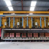
It was crucial, said Ms Needham, to find somewhere nearby that could take all the surplus materials created by carving out the wetland sediment trap and reducing the level of the site – all while minimizing any disturbance to the SSSI and SAC. Fortunately, local brick-makers Forterra offered to receive all 7,500m3 of material from the site for use in the future as part of their clay quarry’s progressive wetland restoration.
‘One of the issues in delivering the project was to drop the level so the site floods better, meaning we had a load of material that needed to move to a receptor site,’ said Ms Needham. ‘Because we’ve been walking the river for years, looking for invasive species, we talk with many farmers and other businesses, which is how we got to know Forterra, whose Measham plant is one of the most efficient and sustainable brick manufacturing facilities in the UK and has an adjacent quarrying excavation perfect for this project.
‘It was instrumental to the success of this project that Forterra could take the significant amount of material. Despite the funding from the DCS, we quite simply would not have been able to afford to complete the project without Forterra’s agreement to receive the material in their quarry.’
According to Ian Loftus, Forterra’s Measham Plant manager, it has been a positive working relationship: ‘We’ve always worked together to iron out any problems and figure out solutions. Compared with the scale of our quarry excavations, these materials are very minor. We were happy to be able to offer our quarry to the river project and use the materials in our own site restoration in years to come.
‘Yes, we dig big holes, but we always have an end plan so that once we’ve finished quarrying, they tend to be returned, at least in part, to nature. This project has been a great example, working with the Trent Rivers Trust to come up with what they think is best for a particular area,’ said Mr Loftus.
Ms Needham added: ‘It’s already transformed the site and will make a positive impact on the river for years to come. There are lots of shallows, gently sloping banks, and softer-shaped channels – a real improvement for biodiversity. There are wet, dry, and semi-dry areas for the invertebrates and there are spaces for the fish to spawn and for wildlife to take refuge when the site floods.
‘We were delighted to complete these major works on time and without disruption or inconvenience to the landowners or Forterra, who have been absolutely instrumental in making it work.’
- Subscribe to Quarry Management, the monthly journal for the mineral products industry, to read articles before they appear on Agg-Net.com


